Geotagging Imagery and Video


IsWHERE is a log of my thoughts, reflections, and news/blog links on the emergence of image and video geospatial tagging. On May5th this year, I opened a second blog to deal with more detailed aspects of tools for FalconView and TalonView can be found at RouteScout. Trends I want to try and follow are the various disruptions resulting from spatial smart-phones, how many GPS devices are out there, smart-cameras, and other related news. And yes, I have a business interest in all of this. My company Red Hen has been pioneering this sort of geomedia for more than a decade.

So beyond a personal blog, I also provide a link to IsWHERE a shareware tool created by Red Hen Systems to readily place geoJPEG or geotagged imagery and soon GEM full motion media kept on your own computer(s) into Google Earth/Map from your File Manager media selection. Works great for geotagged images from Nikon, Ricoh, Sony, iPHONE, Android and all geo-smartphones that can create geotagged images. IsWhere - read about it

IsWhere Free Download (XP and VISTA)

<<<<<<<<<<<<<<<<<<<<<+>>>>>>>>>>>>>>>>>>>>>

IsWhere Visitors

Showing posts with label pointographer. Show all posts

Sunday, June 22, 2008

Nikon GeoTagging - Blue2CAN Nikon Review

Here's how to use geotagging to add location data to your image files.

Here's how to use geotagging to add location data to your image files.
Click for full image.

Dave Johnon
PCWorld

Tuesday, June 26, 2007 1:00 AM PDT

I remember showing photos of my trek through Grand Cayman to a friend a few years ago. "Where were these taken?" she asked me about a particular set of photos. "Hmm," I replied, "I don't remember. The East End, I think. I took so many photos, I can't keep track." At the time, I wished there was some automatic way to tag my photos with location information, so I'd always know where they were taken. Yet another thing I'd never have to remember ever again!

Well, my wish has come true: Geotagging is here. Geotagging is the term for adding location information to your photo files--and it's one of the coolest things ever to happen to digital photography.

The Magic of GPS

How can a camera know where it's taking photos? With the Global Positioning System, of course! The system of navigational satellites that a lot of people now take for granted also lets you geotag your photos. In a perfect world, GPS chips would be built into all digital cameras. But that's not the case right now. Instead, we need to somehow marry GPS and photography to make geotagging work.

The available solutions range from amazingly elegant to somewhat less elegant. Take Red Hen's Blue2Can, for example. In my experience, there's no better geotagging solution.

Click here to view full-size image.

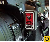
Blue2Can is a thumb-sized gadget that plugs into a small port on the front of several Nikon digital SLRs, including the D200, D2X, D2Xs, and D2Hs. It communicates wirelessly to any Bluetooth GPS receiver, like the kind that sits on your car's dashboard, the clip-on GPS device that I reviewed in May, or the Pharos gadget that combines multimedia features with GPS.

Click for full image.

Blue2Can automatically tags your photos as you take them with GPS data (latitude, longitude, and altitude) that mapping software can read. Take a few pictures with Blue2Can attached to a Nikon camera, then upload them to your Flickr page, for example. Flickr adds a "map" link to each picture--click it and you can see where it was taken. Even cooler: You can view all your photos as pushpins on a map, so you can go on a virtual tour of that Grand Cayman vacation.

Manual Geotagging

But what if you don't have a Blue2Can-compatible Nikon camera? You can add location info after the fact. To do that, carry a GPS receiver with you while you shoot, and then use a program on your PC to synchronize the GPS data with your photos. RoboGEO is a clever program that can read the log from your GPS receiver and mark all your photos with the appropriate locations. And Sony has a gadget custom-designed for just this sort of track-your-movements photo duty, the GPS-CS1.

It is a pretty simple process, but it does involve an extra step to batch-process all your photos when you get them home.

Click for full image.

If you aren't quite ready to step into the world of GPS, there are ways to mark your photos with locations manually. In Flickr, for example, you can display a photo and click the link labeled "Place this photo on a map" to pick a location off a map by hand.

It's not as glamorous as letting a billion-dollar military satellite system do it for you, but the end result is the same: You and your friends can see the photos were taken.
Thursday, March 20, 2008

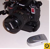
Wintec's Affordable PDN - the WGS-1000

Wintec WGS-1000

Wintec Tiawan has recently added a nifty new handheld GPS device, the WGS-1000. It is the grown-up replacement to an earlier device, the WGS-100.

Brand new to Europe its March'08 release is just now getting attention. The suggest retail is around $100 euros or likely $150 US. Depending on how its functions and screen are used it has very good power longevity of up to 20 hours as a data logger. And data logging is 130,000 points/bread-crumbs large that can be set at time or distance interval logging is quite impressive. The WGS-1000 can be set at rates of up to 4 hertz. Built on a ubox chipset it has well know sensitivity as well as corrected accuracy via WAAS and EGNOS. The WGS-1000 also includes some great sensors: compass, barometer and thermometer. It can be interfaced via either Bluetooth or via a mini-USB connector that doubles as a charging port.

With included software the device's setting can be set, photos geotagged, and tracks downloaded and converted to KML for placing into Google Earth.

  • High Sensitivity Atmel / u-blox Antaris GPS chipset
  • 1 - 4 Hertz epochs setting WAAS / EGNOS
  • LCD display with easy menu structure
  • GPS Data Logger 130,000 points
  • Various screen selections:
    • Navigate, Satellite info, TrackBack, Performance
    • Lunar and Solar Sunset/Sunrise Lunar phase Display
    • TrackBack Feature with Directional "steer-to" display
  • Barometer
  • Electro Magnetic Compass
  • Thermometer
  • Bluetooth and mini-USB connection
  • Rechargeable, replaceable lithium-ion batter (BL-5C format)
  • 20 hours of continuous data logging
  • Water resistant

Wintec may have an entry-GPS winner this time around. While essentially a datalogger with a minimalist PND interface, the WGS-1000 will offer strong competition to entry solutions from Garmin like their Gekos and Colorado handhelds that cost four to five as much.

Thursday, November 29, 2007

ABI Predicts 550 Million Handsets with GPS Features in2012

Key Drivers and Latest Trends Pushing GPS Penetration in CDMA, GSM and WCDMA HandsetsContact

Shipments of GPS-enabled mobile phones will generate over $50 billion in revenues in 2008, rising to $100 billion in 2012. The market for these handsets is expected to grow from around 240 million units in 2008 to over 550 million handset shipments in 2012. At present, most current GPS-enabled handsets are CDMA devices, but increasing numbers of GPS-enabled handsets for 3G/WCDMA networks will start to appear in the market from 2008 onwards.


According to ABI Research industry analyst Shailendra Pandey, “The ongoing consolidation in the mobile industry – including Nokia’s acquisition of NAVTEQ, Broadcom’s acquisition of Global Locate, CSR’s acquisition of NordNav Technologies and Cambridge Positioning Systems, and the tussle between TomTom and Garmin to acquire Tele Atlas – gives a clear indication of the plans and commitment of industry players to address the GPS-enabled handset market.”


ABI Research believes that the mobile industry has reached the stage where we can expect to see rapid growth in the GPS-enabled handset market. From cost and technology perspectives, chipset manufacturers now have solutions in place that will allow the integration of GPS in handsets at low cost and provide significant improvements in terms of accuracy, time-to-first-fix, and reception in indoor environments. On the services side, mobile operators and navigation application developers are coming up with attractive LBS offerings. Also, handset vendors are showing greater interest not only in providing GPS-enabled handsets, but also in introducing their own GPS-centric applications and services.


ABI Research expects the market for GPS-enabled handsets to grow strongly in the next five years. In addition to major handset manufacturers such as Nokia, Motorola, RIM and Samsung, smaller Asian ODMs including HTC, Quanta and Inventec are also introducing GPS-enabled devices. The firm’s new study "GPS-Enabled Mobile Devices" examines the market landscape and future potential for GPS-enabled mobile phones. It discusses the critical business and marketing issues, as well as the market opportunities and challenges facing handset vendors, mobile operators, semiconductor vendors, and other industry players in addressing the GPS-enabled handset market.

Thursday, August 30, 2007

Nikon GeoTagging - Blue2CAN Nikona Review


RedHen Systems Blue2CAN Review
By Jeff Bower (jdbower)
Blue2CAN Review by Nikonian and Jeff Bower


I recently had the pleasure of testing a RedHen Systems Blue2CAN
adapter. This will connect to any Nikon 10-pin remote port (found on
the D200, D2Xs, D2Hs, and similar discontinued models) and provide a Bluetooth interface to a GPS unit. If you’re looking for a refresher on
GPS usage in photography, please take a look at my preceding article entitled “What is GeoTagging?”


Blue2CAN - The Product

When I first learned about the RedHen Blue2CAN I thought it was tiny but it’s even smaller in person. The Blue2CAN measures 28.5mm high by 18.3mm wide by 9.2mm thick (13.9mm thick including the 10-pin connector) and it weighs in at a whopping 7 grams - no need to get a sturdier tripod when using one! Installation couldn’t be easier: just take the 10-pin remote cap off the camera and push the Blue2CAN on. There’s a small click as it seats into place and a mostly hidden red LED flashes once, then three times rapidly a few seconds later when it’s ready to find a GPS.

Summary

The RedHen Systems Blue2CAN works very well and I would recommend it to someone who already has a BlueTooth GPS and wants as tiny a solution as possible. Battery life is acceptable and slightly better than the hotshoe GPS solutions. The biggest downside is that there is no ability to use an external remote with the unit, but there are workarounds. It also may be worth the investment of a CapKeeper to prevent the Blue2CAN from getting lost if it falls out.

Ken, the Red Hen Wizzard, took note and innovated....

As Suggested :


As Implemented - Your wish is our solution:

Saturday, June 30, 2007

Picasa Mobile Photos - Mobile Photo Mapping Next?

http://googleblog.blogspot.com/2007/06/put-your-photos-on-map-and-picasa-on.html

Picasa Mobile Image Mapping Mobile Picasa Albums with Maps!

If you've ever seen a great picture and wondered where it was, wished you could visit that exact spot yourself, or found yourself itching to share a great photo with somebody -- but you were away from a computer, we've got two new features on Picasa Web Albums to help you out. First, we're excited to let you know about 'Map My Photos' -- it lets you show exactly where you took your favorite snapshots. When you share an album with friends, they can see your best photos arrayed on a map (or even Google Earth). It's the perfect way to showcase a memorable road trip or a globe-trotting vacation.


Here's how to get started: when you create a new album, just fill in the optional 'Place Taken' field. You can even drag and drop individual photos directly onto a map, and use built-in Google Maps technology to pinpoint exactly where each was shot. For a quick peek at what the results look like, check out our test gallery.

But wait! There's more. We're also launching the first version of Picasa Web Albums built specifically for mobile devices. You already have a couple of pictures stuffed in your wallet, and maybe even a few wallpapers stored on your phone. But what about all those snapshots you can't carry around? With Picasa Web Albums for mobile devices, your favorite pictures are always with you. So next time you're at a loss for words when describing just how awesome, cute, or beautiful something really was, just grab your phone for visual backup.

Of course, the mobile version of Picasa Web Albums lets you keep track of photo updates from friends and family, too. Just click 'My Favorites' from the main screen to see the latest photo albums that your contacts have posted to Picasa Web Albums -- you can even post a quick comment on their photos, using your phone. Thumbnails and photos are automatically re-sized for your device's screen, so pictures look good and download fast. All you need to get started is a phone with a web browser and a data plan; learn more here.

As you enjoy your summer travels, remember to take plenty of snaps, and share the most beautiful places in the world (and don't forget to use your phone to show off pics from back home!).

Sunday, January 21, 2007

Barefoot Disaster Pointography


Red Hen Systems has a growing list of international users. In the
immediate moments after an natural disaster confusion is the norm as large
effort is expended to realize the extent and severity on the affected
communities. Spatial multimedia or the indexing of images, video and
audio tied into building of a minute-to-minute dynamic map of that
information as provided from the field then immediately sharing and
distributing that content via the web. Sort of bare-footed-CNN
as an effective pathway to insight and conditions in the immediate
aftermath. Reality is connected to place, access can be understood, and
the immediate needs of triage addresses. A hard reality would be to
claim this content as near-real-time citizens "disaster-casting". This
sort of on-the-sport at the moment personal notice and will likely become
more a feature of our daily awareness than less.


Red Hen Systems wants to help harness and enable geo-photographers,
photo-geographers, and all those skilled in every-day pointography to help
accelerate accurate information to assist all in understanding those
affected, to enable effective timely assistance, and help document the
good, the bad, and ugly of recovery. Sort of big stuff but we are going
to give it a fair go. Interested?


Dartmouth
Flood Archives


As a first step, Red Hen is going to try to enable those of our clients
and any of you with interest and skill and likely guts to assist in the
geo-tagging of this critically valuable information, essentially those willing
to do this sort of "on-call" work, to jump-in and
help, to cross-list on volunteers and commercial outfits
willing "to do first" and "talk later" basis via the following site:

Emergency
Geotagging and Disaster Mapping


Monday, December 25, 2006

ISDE5 - aka International GeoTaggers Conference?

Calling all photo-geographers, geo-photographers, and pointographers!!
.


The "earth first" potential of the NASA/Google alliance takes on additional significance given the wide blog-o-sphere announcement of the International Symposium on Digital Earth get-together in San Francisco in this coming June.


On June 5th 2007, the 5th International Symposium on Digital Earth (ISDE5) will open in the Bay Area of San Francisco, California, USA. The symposium will span four days and will address a broad national and international audience across a spectrum of industry, academic, government, and citizen attendees. All individuals who share a common interest in the concept of a digital Earth are urged to participate and attend. The Digital Earth vision embraces a philosophy that any citizen of the planet, linked through the Internet, should be able to freely access a virtual world of information and knowledge resources.


This philosophy supports the dream of ubiquitous education for the people of the planet. A rich convergence of technological advances, active visionaries, and recognition of the paramount need for humans to better understand the Earth and its systems comprises the character and history of this dynamic and exciting enterprise.

This international vision encompasses the virtual and 3-D representation of the earth with vast amounts of scientific, natural, and cultural information that is partially referenced and interconnected with digital knowledge archives from around the planet to describe and understand the Earth, its systems, and human activities.

The Digital Earth community is dedicated to building a virtual global commons to promote "down to Earth" solutions supported by cooperative web-based protocols using standards, databases, analytical and visualization tools that will foster the creation of appropriate applications for a sustainable future. A consortium of global experts founded the International Society for Digital Earth in 2006 to promote the evolution and implementation of the Digital Earth vision.


5th International Symposium on Digital Earth


ISDE5 Nominations

I would like to nominate two candidates that should be IMHO noted contributors to the "down to earth"contributions.

Global Biodiversity Information Facility
(with Google Earth bio-mash)

The GBIF GE Bio-Mash - or where are all those critters?/

The Global Biodiversity Information Facility is building a Internet accessible link to literally millions of "specimens". Most of the world's biologic diversity is located in the developing regions where as the dominate archive of those bio-diverse regions are held within developed nations. Essentially the GBIF is geotagging as much of the known via Google Earth. Put a time line on the collection and its classification and patterns may emerge? Give a HOOT! Don't pollute!

Good managers of natural resources and policy-makers know that their best decisions are based on results from the most accurate scientific analyses. Such analyses are based on solid, documentable data that have been recorded directly from the observation of nature. Such records are called 'primary' data. Biodiversity is a handy, one-word name for all the species on the Earth, the genetic variety they possess, and the ecological systems in which they participate. Another way of thinking about biodiversity is as the 'living resources' portion of 'natural resources'.

A large part of the primary data on biodiversity are the 1.5 - 2.0 billion specimens held in natural history collections, as well as many geographical and ecological observations recorded by various means and stored in various media. In making living resource policy and management choices, decision-makers are often forced to rely on analyses that are not based on primary data. This is because the world's store of primary data about biodiversity is not at present readily and easily accessible.


Biodiversity is found around the world - there are micro-organisms between granules of rock 3 km below the Earth's surface, rootless plants in the Atacama Desert, thousands of species of beetles in a single rain forest tree. However, biodiversity is not distributed evenly across the face of the planet. An estimated 75% of all species are found in the developing world.


Information about biodiversity (natural history collections, library materials, databases) likewise is not distributed evenly around the globe. Three-quarters or more of data about biodiversity are stored in the developed world. However, most of the data that may be needed can't be transferred because either they are not digitised, or capacity to handle digital information is lacking, or both. Facilitating digitisation and global dissemination of primary biodiversity data, so that people from all countries can benefit from the use of the information, is the mission of the (GBIF).

Conservation Air Patrol
(With National Geographic geotagged images)

Conservation Air Patrol

My second nominee group, the Conservation Air Patrol, transverses Africa counting animals, documenting environmental degradation, and from what I hear swatting flies while getting the job done. Read about then add the National Geographic "MegaFlyover" to your Google earth via National Geographic and Wildlife Conservation Societies, “MegaFlyover”. This team plus National Geographic should be considered as enabling one of the original Mash-up".