Geotagging Imagery and Video


IsWHERE is a log of my thoughts, reflections, and news/blog links on the emergence of image and video geospatial tagging. On May5th this year, I opened a second blog to deal with more detailed aspects of tools for FalconView and TalonView can be found at RouteScout. Trends I want to try and follow are the various disruptions resulting from spatial smart-phones, how many GPS devices are out there, smart-cameras, and other related news. And yes, I have a business interest in all of this. My company Red Hen has been pioneering this sort of geomedia for more than a decade.

So beyond a personal blog, I also provide a link to IsWHERE a shareware tool created by Red Hen Systems to readily place geoJPEG or geotagged imagery and soon GEM full motion media kept on your own computer(s) into Google Earth/Map from your File Manager media selection. Works great for geotagged images from Nikon, Ricoh, Sony, iPHONE, Android and all geo-smartphones that can create geotagged images. IsWhere - read about it

IsWhere Free Download (XP and VISTA)

<<<<<<<<<<<<<<<<<<<<<+>>>>>>>>>>>>>>>>>>>>>

IsWhere Visitors

Monday, December 25, 2006

ISDE5 - aka International GeoTaggers Conference?

Calling all photo-geographers, geo-photographers, and pointographers!!
.


The "earth first" potential of the NASA/Google alliance takes on additional significance given the wide blog-o-sphere announcement of the International Symposium on Digital Earth get-together in San Francisco in this coming June.


On June 5th 2007, the 5th International Symposium on Digital Earth (ISDE5) will open in the Bay Area of San Francisco, California, USA. The symposium will span four days and will address a broad national and international audience across a spectrum of industry, academic, government, and citizen attendees. All individuals who share a common interest in the concept of a digital Earth are urged to participate and attend. The Digital Earth vision embraces a philosophy that any citizen of the planet, linked through the Internet, should be able to freely access a virtual world of information and knowledge resources.


This philosophy supports the dream of ubiquitous education for the people of the planet. A rich convergence of technological advances, active visionaries, and recognition of the paramount need for humans to better understand the Earth and its systems comprises the character and history of this dynamic and exciting enterprise.

This international vision encompasses the virtual and 3-D representation of the earth with vast amounts of scientific, natural, and cultural information that is partially referenced and interconnected with digital knowledge archives from around the planet to describe and understand the Earth, its systems, and human activities.

The Digital Earth community is dedicated to building a virtual global commons to promote "down to Earth" solutions supported by cooperative web-based protocols using standards, databases, analytical and visualization tools that will foster the creation of appropriate applications for a sustainable future. A consortium of global experts founded the International Society for Digital Earth in 2006 to promote the evolution and implementation of the Digital Earth vision.


5th International Symposium on Digital Earth


ISDE5 Nominations

I would like to nominate two candidates that should be IMHO noted contributors to the "down to earth"contributions.

Global Biodiversity Information Facility
(with Google Earth bio-mash)

The GBIF GE Bio-Mash - or where are all those critters?/

The Global Biodiversity Information Facility is building a Internet accessible link to literally millions of "specimens". Most of the world's biologic diversity is located in the developing regions where as the dominate archive of those bio-diverse regions are held within developed nations. Essentially the GBIF is geotagging as much of the known via Google Earth. Put a time line on the collection and its classification and patterns may emerge? Give a HOOT! Don't pollute!

Good managers of natural resources and policy-makers know that their best decisions are based on results from the most accurate scientific analyses. Such analyses are based on solid, documentable data that have been recorded directly from the observation of nature. Such records are called 'primary' data. Biodiversity is a handy, one-word name for all the species on the Earth, the genetic variety they possess, and the ecological systems in which they participate. Another way of thinking about biodiversity is as the 'living resources' portion of 'natural resources'.

A large part of the primary data on biodiversity are the 1.5 - 2.0 billion specimens held in natural history collections, as well as many geographical and ecological observations recorded by various means and stored in various media. In making living resource policy and management choices, decision-makers are often forced to rely on analyses that are not based on primary data. This is because the world's store of primary data about biodiversity is not at present readily and easily accessible.


Biodiversity is found around the world - there are micro-organisms between granules of rock 3 km below the Earth's surface, rootless plants in the Atacama Desert, thousands of species of beetles in a single rain forest tree. However, biodiversity is not distributed evenly across the face of the planet. An estimated 75% of all species are found in the developing world.


Information about biodiversity (natural history collections, library materials, databases) likewise is not distributed evenly around the globe. Three-quarters or more of data about biodiversity are stored in the developed world. However, most of the data that may be needed can't be transferred because either they are not digitised, or capacity to handle digital information is lacking, or both. Facilitating digitisation and global dissemination of primary biodiversity data, so that people from all countries can benefit from the use of the information, is the mission of the (GBIF).

Conservation Air Patrol
(With National Geographic geotagged images)

Conservation Air Patrol

My second nominee group, the Conservation Air Patrol, transverses Africa counting animals, documenting environmental degradation, and from what I hear swatting flies while getting the job done. Read about then add the National Geographic "MegaFlyover" to your Google earth via National Geographic and Wildlife Conservation Societies, “MegaFlyover. This team plus National Geographic should be considered as enabling one of the original Mash-up".

Monday, December 18, 2006

Google and NASA - geoTagging via GE just gets better

http://www.prnewswire.com/cgi-bin/stories.pl?ACCT=104&STORY=/www/story/12-18-2006/0004493013&EDATE=

NASA and Google to Bring Space Exploration Down to Earth
MOFFETT FIELD, Calif., Dec. 18
/PRNewswire/ --

NASA Ames Research Center and Google have signed a Space Act Agreement that formally
establishes a relationship to work together on a variety of challenging technical problems ranging from large-scale data management and massively distributed computing, to human-computer interfaces.

As the first in a series of joint collaborations, Google and Ames will focus on making the most useful of NASA's information available on the Internet. Real-time weather visualization and forecasting, high-resolution 3- D maps of the moon and Mars, real-time tracking of the International Space Station and the space shuttle will be explored in the future.

"This agreement between NASA and Google will soon allow every American to experience a virtual flight over the surface of the moon or through the canyons of Mars," said NASA Administrator Michael Griffin at Headquarters in Washington. "This innovative combination of information technology and space science will make NASA's space exploration work accessible to
everyone," added Griffin. "Partnering with NASA made perfect sense for Google, as it has a wealth of technical expertise and data that will be of great use to Google as we look to tackle many computing issues on behalf of our users," said Eric Schmidt, chief executive officer of Google. "We're pleased to move forward to collaborate on a variety of technical challenges through the signing of the Space Act Agreement."

Recently, teams from NASA and Google met to discuss the many challenging computer science problems facing both organizations and possible joint collaborations that could help address them. NASA and Google intend to collaborate in a variety of areas, including incorporating agency data sets in Google Earth, focusing on user studies and cognitive modeling for human computer interaction, and science data search utilizing a variety of Google features and products.

"Our collaboration with Google will demonstrate that the private and public sectors can accomplish great things together," said S. Pete Worden, Ames center director. "I want NASA Ames to establish partnerships with the private sector that will encourage innovation, while advancing the Vision for Space Exploration and commercial interests," Worden added.
"NASA has collected and processed more information about our planet and universe than any other entity in the history of humanity," said Chris C. Kemp, director of strategic business development at Ames. "Even though this information was collected for the benefit of everyone, and much is in the public domain, the vast majority of this information is scattered and
difficult for non-experts to access and to understand. "We've worked hard over the past year to implement an agreement that enables NASA and Google to work closely together on a wide range of innovative collaborations," said Kemp. "We are bringing together some of the best research scientists and engineers to form teams to make more of NASA's vast information accessible."

NASA and Google also are finalizing details for additional collaborations that include joint research, products, facilities, education and missions. Google's innovative search technologies connect millions of people around the world with information every day. Google is headquartered close to Ames in Silicon Valley with offices through the Americas, Europe and
Asia.

For more information about Google, please visit:
http://www.google.com
For information about NASA and agency programs, please visit:
http://www.nasa.gov

Tuesday, December 12, 2006

Geotaggers Classifications?

The Homesteading GIS'ers
Photo-geographers:
GIS-centric scientists that use spatial imagery and videography for photogametry calculation, cartographic illustration of spatial relationships and landscape textures and context. The utility is project intensive with complex spatial presentations integrating many complex GIS layers and background imagery. Requires GIS skills and ESRI-like softwares and sciences.

The Enterprise Opportunity
Geo-photographers:
Media-centric innovators designing utility within enterprises; sometimes providing geotagged media as services to enterprise requirements. Supported by budgeted programs and in-situ platforms with emphasis on spatial data normalization, compression, and archive redundancy. Streamlining of complex media collections for enterprise utility. Requires repeatable mission, rationalization of the corporate data dictionary, a dedicated team and processing center.

Pointography Ignition
Point and shoot pointography: A pointographer is an individual who uses a cheap point-and-shoot camera, while having the courage and dignity or lack-off rather... to call him/her-self a photographer (http://www.urbandictionary.com/define.php?term=pointography). Web-centric ease of use anywhere, anytime, by anyone and everyone including mashing-up spatial image sharing. Business model to construct around a peer to peer sharing of geotagged material.

Thoughts?

Saturday, December 09, 2006

Camera Phone Domination and Photo-tagging

I have hunted around the blogo-sphere and have not really found anyone pealing back the onion on the macro trends of digital imagery. So here goes... sweeping commentary and a few links that may confirm the issues.

The single most important idea you need to agree to: once camera phones gets more than 2-3 mega pixels resolution they (will) take over the role of digital cameras for most applications and users. BUT, the argument goes camera phones still are in need of better a lens. Well that too is coming in the next year likely.

Interesting almost factoid - for a huge portion of the world, the first camera they ever will own will be integrated into their mobile phone.

Why is this important? Well for those just now getting involved with the industry of digital cameras and its total disruption of film and chemical photography, the camera phone is truly the disruptive technology that is killing analog cameras... other than disposables, and is poised to do the same to most forms of digital cameras as well. Hence the better lensed SLR designs that are going to be gift choices this season?

The big picture?

http://www.mobileimagingreport.com/Mobile_Imaging.htm

IMHO I think the group over at Future Imaging have pretty much nailed back in 2004 the unfolding macro/vision of what is really going on. The graph above is one of theirs and suggests two critical cross-overs.

The BIG DEAL first happened around mid-year 2003 when digital cameras on a units basis out sold film cameras - a non-Kodak moment as well! The other less well known event occurred when camera phones jumped over digital cameras but that went un-noticed as the images from the first camera phones really sucked - they still do in most cases. So what now? As we approach 2007, the Future Images group had the concept but missed the actual numbers by only 100 percent... Gosh it wasn't 350 million is was 800 camera phones!

The Lycra Research Group re-confirmed imagery industry disruption this past July when they published these next two graphs. They were a bit more forgiving in that their industry survey suggests that digital cameras only this past summer exceeded film cameras... (I guess that gave Kodak a bit more wiggle room?). But they too deliver the same message - camera phones simply will dominate.

http://www.lyra.com/lh3m.nsf/Home

Ok, now you are on to it. But the industry remains in turmoil. Back in 2004 I was able to watch Kodak joke and squirm with HP in that they too wished they could produce printer cartridges... a replacement for chemicals, films and special papers. So out came kiosks and "digital print centers" to get you and your memories on paper! NOT!!


So the last concept you need for this moment is to digest what the "image sharing" web sites are now doing to kiosks and print centers... Here is a rule of thumb to carry around.

According to Webshots (400 million images on their system - 17 million users - sharing around 85 percent of their images) out of 100,000 uploaded images under 1000 are printed. Active sharing rules...

Oh, and without "tagging" most shared images are useless?

That enough to get me in trouble so ...

Later,

MidNight Mapper

Monday, December 04, 2006

GeoTagging Tourism

Dr Joe Berry dropped an interesting "photo-map-lett" on my desk today - geoTagging Tourism. The idea is to create, in this case, a resort "photo-map" of places within the resort and those adajacent so that guests can both find and see what might be available. The result is suggested below and is a HTML page generated by MediaMapper.


http://63.78.10.20/basis/MMMaps/LosAbrigados/


This example, a resort in the Southwest, was created by a walk-around geo-pointograher (non-professional point-and-shootist with GPS) and then assembled in MediaMapper. The images were geotagged and organized into two general groups: day-shots (red dot) and night-shots (black-dot). The black and white background imagery comes from Microsoft's Terraserver USA and the color block clipped from Google Earth and added/reqistered with in MediaMapper (this might be a strech on the GE license?). Some instructions were added and then the HTML generated.

Total time from start to posting the HTML - likley an hour or two no more - including the walk-about. Value to the resort - maybe not priceless but still valuable if seasonality or specialized content for a group's venue counts?

The resulting web page provides both tumb-nail and map cross-reference: click on a map point and the image is identified; click on an image and its placement is highlighted. Try the link above!

MicroSoft TerraServer USA - http://terraserver.microsoft.com/

Google Earth - http://earth.google.com/

Mediamapper - http://www.mediamapper.com

Dr Joe Berry - http://www.innovativegis.com/basis/

Saturday, December 02, 2006

More on Geotagging Statistics

"Every picture has its place" is the conceptual base from which geotagging provides an index to imagery. When you approach Fickr to see the "where are" all those millions of images, you don't get much of a picture or a map. The Flickr map above should show the distribution of all ~7.8 million images as of today. It does not.

What this map of all geotagged images (7.8 million plus) displays are recent additions aggregated by a clustering solution that operates at all scales of the Yahoo map. You do not get any feel for where all that imagery is - Flickr's world-wide image distribution?


When you change the scale by zooming in on a region of interest, the visualization of the image clusters becomes more refined. In this case, Big Bend National Park there is a central cluster marked as "Lots".... Man, is this slow. It works but its slow... lots of spatial sorting going on.


Zooming in again.... centered on the "Lots" cluster you now find yet another cluster set.

Yep, I am starting to get a feel for what might be going on. The zooming and panning control are really not well organized IMHO - slider bars simply suck. Waiting, waiting... slow!
Doesn't really do much for me.. you need to change the scale to get intimate with the positional excitement.


I am now zoomed in as close as Flickr can go. The central image cluster I am most interested in can now be found and selected. Yes, I get images and in this case they are all from a single author.


Maybe a mash-up might help? Lets try something more GIS-like?

Back in mid-September a Beau Gunderson used ArcGIS and a world-wide grid to count Flickr images with-in each grid area. Each grid was then grouped as to the total count and shaded according to the aggregate count in each individual grid. This created a 'choropleth" map. Its a visual statistic of ~2.5 million Flickr images where the more yellow grids have the higher counts of Flickr images falling in them. (see http://www.beaugunderson.com/flickr/ for the KML down load. Lets hope Beau runs an up date +5 million images later?)
What happens when we zoom in on Big National Park? Wow, this is fast...

Hmmmm, yep I see the park boundary but the Park is bisected by two grids - one counting 700+ images and the other only 30+ or so. The grid "resolution" breaks down at this scale. The label on the choropleth map certainly shows the aggregate count and is really fast but it needs a finer grid to help sort out where the pictures of interest are. Also the colorization/class by gird should indicate grid count difference but it does not. It's also out-of-date. Bummer!

What I am trying to lead you to is that there are two methods to providing a visual statistic that IMHO will be used to help organize the millions and soon billions of geotagged images being shared. One is more precise, the Flickr cluster method, and the second is far faster but has both a currency lag as well as break-down of visual comparison that fails at a larger scale when its grid and its classification do not fit a finer resolution requirement.

"Vector is more corrector... but raster is faster" ... GIS insight from Dr. Joe Berry (http://www.innovativegis.com/basis/).

Friday, December 01, 2006

Geotagging Statistics

Was curious about the "total count" progress for geotagging imagery. Trying to find direct counts as well as proxies. I went through my notes and here are some quick observations.

Flickr started formally "geotagging" images on or about the 28th of August. They suggest they have around 300 million images; all in around 7.8 million are geo tagged as of the end of November 2006.

August 28th - the start - assume 0
August 29th - 1.234,284 million
September 9th - around 2.5 million
November 20th - 7.340,532 million
December 1st - 7.848,101 million

On average this works out to around 80,000 images per day for 93 days or so... seems to be declining a bit from one million per day at opening to a bit over 50k in recent days. Still a heap.

Also ran on to a stat from WebShots... they have around 397,000,000 images as of end of November. They have quite a good geographical organization in that there is a long list of images organized by goeraphical name - but no obvious map yet...

Kodak's Easyshare is rumored to be approaching a billion total images. Nothing obvious as to location though but I have not spent much time digging into what they are doing.

Zooomr is also hunting the geotagger. The have an interestig map up but just now it was a bit jammed..

Any other insights to the geotagging of imagery?

Monday, November 27, 2006

Correction - You get only back what you give

Wow my first response! And a need for my correction.

In the post below is a response from a geoTagger with Flickr. Apparently what ever you pass into Flickr in terms of EXIF content you get back? Also there is a hint that Flickr may soon pass along the Flickr Tags as an option but then again the potential compexity of the "tagging" might overwhelm EXIF standards?

EXIF has all sorts of potential but its design is a tad complex. Adobie has a companion file design that might be a "next step" standard? Will think about this a bit more and post some info in a week or so.

Time will tell....

Flickr - One Way Only?

Excuse my absence. Been busy moving.

I do have an observation that really has me a bit disturbed on the apparent one-way-ization of Flickr images. While exploring the Flickr "tagging" phenomena I discovered that when you down-load a Flickr image, either mine or other shared images, they arrive essentially stripped of all their tags including normal EXIF data they started with? I guess the Yahoo outfit does not like the idea that tagged images might be used elsewhere? There must be money "money in-them-thar Flickr images"? Once they got you by your pictures, the rest soon follows?

On the other hand, images that I have good EXIF data in when shared via Picasa.net retains the EXIF metadata - up and down. Only "detail" is you need to download a shared catalog with Picasa. But once they are on your local drive, you can work with them via Adobe and other image processing tools.

I prefer the Picasa.net design and attitude towards sharing an image's metadata: keep your images on your own storage, upload only the ones you really want to share, and then pass around the proper link to your shared catalogs. Those that download your shared catalogs get the metadata as well.

If you want to explore some of the differences between Flickr and Picasa.Net take a read at:

http://retrovirus.com/incr/

"First step: get the photos into Picasa, Google’s excellent free Windows photo organizer. I used FlickrDown to download the photoset from Flickr to my Windows box. It was simple, though I was sad that there was no way to preserve my photos’ tags. I then downloaded the new version of Picasa from the Picasa Web Albums site. (You need to get this specific version to be able to do the fancy stuff I’m about to describe.) Picasa immediately found and imported the downloaded photos—so far, so good."

Thursday, October 26, 2006

geoTagging eRRors an d Bias

I have been inspecting the results of the registering of my collections, aka catalogs, of geoEXIFed imagery placed into Google Earth by several pathways. To frame this story -

I have a tad over 11,000 geoEXIFed and other geo-tagged images collected during the last decade. My spatial image inventory has been collected with the various Red Hen Systems tools. Recently I have also been collecting from the WEB goe-spatial images shared via Flickr and Google Earth. I have also used Picasa.NET to move reospatial images around.

I also have spatial video, maybe 120 hours in aggregate - I have a couple of legacy tapes pending as my "one/first" Maxtor external 250GB external is pretty much full-up. With much procastination, blood, sweat, tears, and hours I have so far sucessfully rendered that stack of video down to 28 clips totalling 135 minutes of 30fps NSTC, PAL and MPEG-2 videos explaining maybe four or five stories or themes. Today, I am browsing that imagery via Picasa.NET and Adobe's Lightroom Beta. I have leared to be reasonably productive with Adobe Premier for the video. Red Hen imagery and video mapping products have contributed the spatial slice-and-dice environment as well as generation of ESRI personal geobase, HTML and Flash cartographic work-products. How many CODECs? Wouldn't bet it was less than a half-dozen? I want to find an easy way to do the same within Google Maps.

I was able to join in Picasa NET Beta some months ago and was excited when I found the "Geotag > View in Google Earth" Tool option. It didn't initially work (accept images) but offered the opportunity. Today the "View in Google Earth" Picasa.NET option does a reasonable job although in some places it is still a bit rough IMHO - like no obvious "Blogger" map in this Beta . While I can not fully endorse Picasa, the more I use it the better the results I get. The .NET version remains in Beta, you'll need to have a gmail account, and expect an update say every three to six weeks?

My 11,000 geotagged images come with all sorts of legacies, collection methods, GPS accuracies, and geoEXIFing method. These are a few of the sources that can contribute positional wobble and uncertainty to an image's absolute position. How much accuracy does a geo-photo require? It depends. And when combined, these errors and those found within Google Earth/Maps and the GIS sciences generally, sometimes disappoint expectations. I too have been disappointed and to channel frustration, I am trying to understand the various sources of pure bias, trend, and residual error as a worthy interest. For the GISer this is table-speak as we are longer toothed on issues of GPS and how to lie with maps. To better understand camera wobble - the photography domain I seek illumination. The next several notes following will try to explain what I have seen and what I think may be going on.

GPS WObble

In the "old" days, before WAAS and when SA=ON, GPS position was guaranteed to be 100 meters off at any time (2RMS) and as much as 300 meters off on the 3RMS+ extremes. My posting experience suggests that the GPS WObble for that era was more typically 20-40 meters.

More recently, GPS accuracy has improved from 100 to three meters, cost per device are under $150, and form is the size of a matchbook. My preferred GPS solution these days are SiRFstarIII chip-sets which delivers 20-channel, massively correlated and WAAS corrected NMEA strings over Bluetooth.

What sort of accuracy should we expect with current SiRFstar III Bluetooth GPS devices? There are many relative and absolute position qualities I could digress to but for now lets assume good WGS84 certainty at the street level. The GPS accuracy is a positional accuracy of a few meters. An operationally good GPS condition would indicate PDOP is low (<2),>6), each with matching RTCM differentials that are both tight in space and latency. These conditions when matched to smart GPS software calculating an over-determined solution, the SiRFstarIII chip-set should be delivering antenna location in WGS Lat/long six decimal precision to within three meters at 2RMS and under one meter CEP or half the time. Is this good enough? One meter gets you there when ten will not? Seems good for me but maybe a serious geo-cacher might drop in on us and set the story right? As for elevation error or noise, a rule-of-thumb is 2-3 times the X/Y 2RMS error.

In my spatial image collection, a good portion have PDOP as well as the presence or absence of the WAAS or other RTCM differentials. These are indices of GPS performance. For some elite catalogs with well populated EXIF headers there will be images with orientation, distance to POI, edition information, image adjustment, and other tags. In some cases, the image might have associated sensors and both their data records plus their meta data. Neither that fit well a standard EXIF structure. In this case, innovation has required a GPS "LOG" or companion files that includes both NMEA and $ proprietary strings.

Squinty Eyes and Picture WObble

As far as resolution of my geoEXIFed catalog, I have lots of VGA, 1.3 mega pixel, and five mega pixel JPEGs. I have five mega pixel hand-camera for years now and have almost gone SLR at home. As a point-and-shoot pointographer the sweet-spot 3.5 mp image seems the more likely adjustment via my next smartphone. I have used many versions of Nokia camera phones and have a Fuji five mega pixel FinePix must be four years old now. Its handled the abuse well although I have acquired some sort of fungus that is devouring something that supports the display. Pixels are dieing in a hyphael pattern. I am learning how to improve poor images. Picasa is does an Ok job but I prefer the feel, organization, and quality offered in Adobe's Lightroom Beta. I know how to fix some of the issues of digital camera error - white balance, lens jitter, lighting issues, and other cool stuff I too can move sliders and embellish "my" imagery.

Hard-knocks experience tells me its time to move beyond JPEG or even JPEG2000. I like what Microsoft is doing with SeaDragon, Windows Media Photo and Photosynth. These are products from their Media Lab's propeller heads and will soon appear with Microsoft's next-generation of OS.

I also have some other odd-sets received mostly from friends - all but a scant few via CD. I a very small but growing inventory of images received from the Internet via sharing. I really like immersive imagery and when well-done, I could digg 3D. So much so watch this space for more on 3D-immersion! I only print to paper a small number of images say 1:500. I am starting to get quite excited about the sharing of images as a digital proxy for paper printing.

I am certain I am finding location wobble that likely others have or are facing both knowing and not. This "wobble" should be considered a new source of lens jitter in digital imaging. Solution? Good technique and/or innovative technology can minimize this. Further each method to geoEXIF the image have both common sources of error and well as significant limitations.

I want an easy way to minimise duplication of my media. But I also want a reliable way to re-organize my work products to my camera phone and allow easy creation of CDs, DVDs, and external disk storage for my use and for my clients. I am finding it too easy in my processing to create duplicates. Worse is the related fear to delete something you know you don't need but are uncertain if you have consolidated all of the changes... and other subconscious Delete - are you certain? fears. And duplicates in Picasa are very confusing IMHO. The have a stub for dupes but I have yet to see a understandable result. So I will await the update?

Tuesday, October 17, 2006

Symbian Personal Navigation and Bluetooth GPS Transceivers

The Bluetooth GPS Transceiver (BtGPS) has a very high utility if you can demonstrate a must-have personal navigation device/solution. Interested? And navigation, I have heard is the necessary base of many rather cool LBS services .... soon to come.... someday?


Adding a BtGPS device to your "mobile" kit will cost around $100 and will be connected to your Symbian Series 60 with Bluetooth features in a few minutes. Then if your smartphone includes a "data plan" that provides you mobile Internet access, well, from that moment on and depending how you adapt to yet another blinking light and its battery hassles, you can:

  • find where you are,
  • locate where someone else is,
  • review where you have been,
  • calculate the best way of getting where you want to go, and
  • recall places or faces of interest you have found or want to find.
  • plus WiFi hotspot radar?

ALL with a geotagging positional tolerance of a only a meter or three.

While there are many BtGPS devices, a MidNight recommendation would include "SiRF" and its chipset SiRFstarIII. These 20-channel, WAAS capable, and massively correlated devices can deliver a 2 meter CEP in low PDOP conditions. Bluetooth positional error of dilution is no greater than 10 meters most conditions. Main differentiations will be blink-blink, battery size, and stuff like TTFF CS and WS. I prefer RoyalTek RBT-2001 due to its smarter and compact implementation, TTFF CS, TTFF WS, and battery selection (identical to most Nokia handsets - 0.700 amp/hr). The RoyalTek's use of an easily-had NiCad battery offers an alternate charging path for the same battery form (12-15v cigarette plug step-down to 5-volt PDA/PND plug-end) which has rescued dead and dieing mobiles too many times to be dismissed.
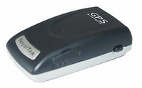
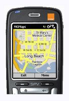
Once you have the BtGPS figured out, I am encouraging you to immediately download a copy of the MGmaps. It is a very excellent personal navigation device application for your Symbian 60 smartphone. Its a get your map anywhere/anytime via downloading Google Map streets and satelite images via the Google Mobile design.

http://www.mgmaps.com

You can also render the Nokia/Symbian application on your PC just to see it do its thing. You'll need to first check your JAVA and then likely download a JAVA set from the page below...

And you can share KMLs TOO!


Tuesday, October 10, 2006

Navman's NavPixs and IsWhere

Navman has created a rather nifty PNA (personal navigation assistant) that combines auto-routing to geotagged images. Select the place of interest via the photo-base and a route from where you are to the image place is routed for you.


Monday, October 09, 2006

Google Earth and IsWhere


IsWhere permits any selected geoEXIFed images to be viewed in Google Earth. These images we collected with GPStagIT. For example any geoEXIFed image created by the Nikon DX2 or Ricoh Spatial Cameras can be so posted.

Technocrati Claim

Technorati Profile

Monday, August 28, 2006

Welcome

IsWhere for Google Earth, a simple, easy to use utility that displays where each photo was taken on a map. IsWhere uses spatially matched images, also called Red Hen Photos. A Red Hen Photo is any image that has Global Positioning System (GPS) data stored in the image's EXIF header. The IsWhere program now provides a method for photographers and photo analysts to quickly verify the spatial location where a photo was taken. Using a simple right click or drag and drop selection, users pass images into IsWhere to quickly display the image's location inside the Google Earth program.
IsWhere is a great way to see "what is where." Whether you are mapping out your vacation photos, documenting favorite restaurants or identifying potential building sites, IsWhere gives you the power to easily see where each photo was taken. Save the photos in your favorite places or email them to others for them to map and view. IsWhere makes it easy to SNAP, MAP, and SHARE your world.

IsWhere currently can post images to Google Earth from spatially smart digital cameras like Ricoh and Nikon.