Geotagging Imagery and Video


IsWHERE is a log of my thoughts, reflections, and news/blog links on the emergence of image and video geospatial tagging. On May5th this year, I opened a second blog to deal with more detailed aspects of tools for FalconView and TalonView can be found at RouteScout. Trends I want to try and follow are the various disruptions resulting from spatial smart-phones, how many GPS devices are out there, smart-cameras, and other related news. And yes, I have a business interest in all of this. My company Red Hen has been pioneering this sort of geomedia for more than a decade.

So beyond a personal blog, I also provide a link to IsWHERE a shareware tool created by Red Hen Systems to readily place geoJPEG or geotagged imagery and soon GEM full motion media kept on your own computer(s) into Google Earth/Map from your File Manager media selection. Works great for geotagged images from Nikon, Ricoh, Sony, iPHONE, Android and all geo-smartphones that can create geotagged images. IsWhere - read about it

IsWhere Free Download (XP and VISTA)

<<<<<<<<<<<<<<<<<<<<<+>>>>>>>>>>>>>>>>>>>>>

IsWhere Visitors

Showing posts with label geotag. Show all posts

Saturday, January 10, 2009

GPS Manufacturers Face a Rapidly Changing Market... GPS Phones th

Over the last couple of years I have tried to document the impact adding GPS into most smartphones is going to have or having on the major manufacurers of GPS parts, piences and products. Essentially GPS World is preparing the industry for likely consolidation?

GPS World's OEM Insights — January 2009

"In all, about six to eight major retailers accounted for the majority of GPS/PND sales last year...."

2008 started out sunny and warm as I remember. We all said goodbye to 2007 and a holiday buying spree that exceeded all expectation. With a new year of windfall profits behind them, GPS manufacturers, their shareholders, analysts and investors were confident 2008 would be even better. There were two types of disasters in 2008, however: no. 1 (self inflicted) was created by poor management, over valuation, and lack of insight. The second disaster can be attributed to the general economic market collapse of 2008

In the professional .land use products market, mentioned early, companies suffered setbacks as their main business of productivity solutions targeted the slumping construction, mining ,and utility infrastructure segment. Trimble was seen to tumble in the disaster no. 2 scenario. Although times were tougher, the companies key executives tended to spend a lot of time fine tuning their own compensation packages and stock programs while facing some early heat this year about the reasoning behind the stock repurchase plan, which was used to prop up the stock price. But they know the value of being low key and that accounts for a lot these days.

According to a select group industry watchers, times will be tough for the PND. "This PND space is absolutely going in the crapper," said Jeff Evanson, an analyst at Dougherty & Co. Evanson sees several factors leading to a "dramatic slowdown" in PND sales, including a lack of innovation in PND products for holiday season, signs of market saturation, and competition for consumer spending.

Friday, October 17, 2008

GeoTagging GPS Accuracy

GPS Performance Standard Document Updated - GPS World

The National Executive Committee for Space-Based Positioning, Navigation, and Timing (PNT) has released an updated civil GPS Standard Positioning Service Performance Standard, committing the United States Department of Defense (DoD) to an improved level of GPS accuracy for civilian signals.

It is the fourth revision of the standard positioning service (SPS) performance standards document, and the first update since October 2001. In addition to specifying GPS minimum performance commitments, the SPS performance standard serves as a technical document designed to complement the GPS Signal in Space (SIS) Interface Specification.

The most significant change in the updated SPS standards is a 33 percent improvement in the minimum level of SIS range accuracy, from 6 meters root mean square (rms) accuracy to 4 meters rms (7.8 meters, 95 percent), according to the document, which is drafted by the DoD and released through the PNT committee.


While the stated dedication to improvement is notable, it has a built-in conservative margin for minimum performance; as the documents authors note in the executive summary: "with current (2007) SIS accuracy, well designed GPS receivers have been achieving horizontal accuracy of 3 meters or better and vertical accuracy of 5 meters or better, 95 percent of the time."

The full SPS document can be found on the National Executive Committee for Space-Based Positioning, Navigation, and Timing website.

Sunday, June 22, 2008

Nikon GeoTagging - Blue2CAN Nikon Review

Here's how to use geotagging to add location data to your image files.

Here's how to use geotagging to add location data to your image files.

Click for full image.

Dave Johnon
PCWorld

Tuesday, June 26, 2007 1:00 AM PDT

I remember showing photos of my trek through Grand Cayman to a friend a few years ago. "Where were these taken?" she asked me about a particular set of photos. "Hmm," I replied, "I don't remember. The East End, I think. I took so many photos, I can't keep track." At the time, I wished there was some automatic way to tag my photos with location information, so I'd always know where they were taken. Yet another thing I'd never have to remember ever again!

Well, my wish has come true: Geotagging is here. Geotagging is the term for adding location information to your photo files--and it's one of the coolest things ever to happen to digital photography.

The Magic of GPS

How can a camera know where it's taking photos? With the Global Positioning System, of course! The system of navigational satellites that a lot of people now take for granted also lets you geotag your photos. In a perfect world, GPS chips would be built into all digital cameras. But that's not the case right now. Instead, we need to somehow marry GPS and photography to make geotagging work.

The available solutions range from amazingly elegant to somewhat less elegant. Take Red Hen's Blue2Can, for example. In my experience, there's no better geotagging solution.

Click here to view full-size image.

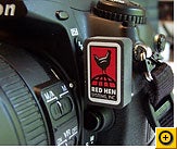
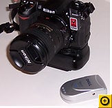
Blue2Can is a thumb-sized gadget that plugs into a small port on the front of several Nikon digital SLRs, including the D200, D2X, D2Xs, and D2Hs. It communicates wirelessly to any Bluetooth GPS receiver, like the kind that sits on your car's dashboard, the clip-on GPS device that I reviewed in May, or the Pharos gadget that combines multimedia features with GPS.

Click for full image.

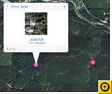
Blue2Can automatically tags your photos as you take them with GPS data (latitude, longitude, and altitude) that mapping software can read. Take a few pictures with Blue2Can attached to a Nikon camera, then upload them to your Flickr page, for example. Flickr adds a "map" link to each picture--click it and you can see where it was taken. Even cooler: You can view all your photos as pushpins on a map, so you can go on a virtual tour of that Grand Cayman vacation.

Manual Geotagging

But what if you don't have a Blue2Can-compatible Nikon camera? You can add location info after the fact. To do that, carry a GPS receiver with you while you shoot, and then use a program on your PC to synchronize the GPS data with your photos. RoboGEO is a clever program that can read the log from your GPS receiver and mark all your photos with the appropriate locations. And Sony has a gadget custom-designed for just this sort of track-your-movements photo duty, the GPS-CS1.

It is a pretty simple process, but it does involve an extra step to batch-process all your photos when you get them home.

Click for full image.

If you aren't quite ready to step into the world of GPS, there are ways to mark your photos with locations manually. In Flickr, for example, you can display a photo and click the link labeled "Place this photo on a map" to pick a location off a map by hand.

It's not as glamorous as letting a billion-dollar military satellite system do it for you, but the end result is the same: You and your friends can see the photos were taken.

Saturday, June 21, 2008

Blue2CAN Review

Review of Red Hen Blue2CAN GPS Unit

Ruth Happel/Wild Portraits

The Red Hen Blue2CAN unit is one of the latest emerging technologies allowing photographers to encode GPS data with their photographs. I have earlier explored the many reasons why this is important (see http://wildportraits.com/gps.aspx for more details on GPS and photography), but the most obvious is the ability to sort photos by not only time but place.

As an early adopter of combining GPS with photography, I am always looking for the ultimate solution in allowing me to collect location data automatically with my photographs. I have had the pleasure of using the Red Hen Blue2CAN for the past month, and can fully endorse it. My early adoption of GPS units with my Nikon D200 has kept me searching for the optimal geotagging solution, and this latest unit from Red Hen is a welcome addition.

The Blue2CAN is a BlueTooth unit, and locks onto signals relatively quickly. The Red Hen unit works automatically with many Nikon DSLR cameras, including the D200, D2X and D2Xs), D2Hs, D3 and D300. It connects to the Nikon 10-pin remote on the front of the camera. It is also necessary to have a BlueTooth GPS receiver, as the unit connects to any nearby GPS receiver. If for some reason you have 2 BlueTooth devices, simply move one out of range (approximately 30 feet) until the desired unit connects to the camera, and then it stays locked on.

When first attaching the unit, the camera should be off. Once the camera is turned on, the light on the unit will flash 3 times, then search for a GPS unit. It continues to search at 20 second intervals until it makes a connection with a GPS. In field testing the unit, it locked on slightly faster than other units I have been using. In my experience, it kept the signal reliably, as long as the GPS unit is located within about 30 feet. Once it has locked on, it stays locked, allowing very fast startup.

It is a very small, measuring only about ¾"by 3/8". Unlike other units I have been using, it plugs right into the 10 pin connector, requiring no bulky mounts or cables. It is therefore by far the easiest of any unit I have ever had, adding a minimal footprint to the camera. Another major plus is its battery usage. I have found with other units that my camera is drained quickly when I leave the GPS unit attached, even when the camera is turned off. With the Red Hen unit, I have seen very little difference in battery life with the unit attached, so I have just left it on all the time, ready for instant use.

In practice, the Red Hen is very easy to use. In setting up the properties, through the menu, I simply enabled the Auto Meter function. Since the unit is designed to work with the Nikon technology, this then ensured all my pictures were stamped with the GPS data.

After a month of using the Blue2CAN, I can honestly say it is my new favorite GPS technology. It is so light and easy to use, I am really happy to be free of all the previous contraptions I have had connecting the GPS to the camera. This, combined with its significantly lower battery usage, make this unit a real winner. I strongly recommend it to anyone considering integrating GPS data with photography.

Thursday, June 05, 2008

2.8 Billion Mobile GPS Devices in Four Years!

Worldwide shipments of GPS-integrated mobile devices will grow at an annualized rate of nearly 40% over the next five years, reaching 834 million units in 2012, according to Parks Associates' new report: "GPS: A Path to New Applications on Mobile Devices".

The report looks at a variety of mobile devices, including personal navigation devices (PNDs), mobile handsets and smartphones, portable media players, and personal digital assistants (PDAs). “Mobile handsets and smartphones will constitute the majority of shipments up to 2012, but PNDs will remain the most widely used and preferred navigation choice in the next three years,” said Harry Wang, senior analyst, Parks Associates.

"GPS will come to your mobile handset as a standard feature, but mobile carriers are still a couple of years away from turning GPS into a money-making, mass-market feature," Wang added. “Currently, consumers prefer PNDs thanks to the combination of a bigger screen, more versatile functions, and growing affordability”.

"The use of navigational services on mobile phones will lag behind adoption of PNDs and GPS-integrated handsets in the near term, [but] carriers can boost consumer interest and usage by developing flexible and innovative services and revenue models."

Saturday, April 12, 2008

Blue2CAN Updated - faster, lower power use, better geotagging


Blue2CAN UPDATE:

You asked, and we delivered!

The firmware in the Blue2CAN has been re-architected, Rev C, to enhance the functionality and improve compatibility with various types of Bluetooth GPS units. WAIT! What if you have the earlier version of the Blue2CAN? Contact beth@redhensystems.com for more information.

Sunday, April 06, 2008

GeoTag Icon

What's this all about in a nutshell?

http://www.geotagicons.com/

The Geotag Icon is intended as a web "standard" icon for identifying geotagged content to humans.

The advent of inexpensive GPS devices and free tools like Google Maps or Flickr Map mean that more and more people are associating their content (typically blog posts or photos) with a specific geographic location. Such "geotagging" stores coordinates within metadata or microformat tags—where machines can find them but people can't.

That's where the Geotag Icon comes in. It provides a visual reference to a map link, or if no link is yet made helps viewers recognize the geographic relevance of the content.

It's free, easy to use and helps us all visualize the developing semantic web.

Monday, March 31, 2008

Blue2CAN GPS and Nikon D Series Cameras

Red Hen Blue2CAN for Nikon D3 and D300 GPS cameras review
Article by Mike Barrett
March 29, 2008

Pocket GPS World

Last year Nikon announced the latest in their range of Digital SLR cameras, the D3 and D300. These are targeted at the top of the range with a price tag of £3400 for the D3 (yes that is three thousand) and a slightly more affordable £1300 for the D300.

Red Hen Systems have produced a tiny Bluetooth adapter that connects to a bluetooth GPS and transmits the GPS data to the camera: the Blue2CAN. The Blue2CAN retails at $279 USD.

Both new Nikon cameras have a special 10 pin connector which amongst other functions allows you to connect a GPS to the camera. This then provides a NMEA datastream from which the camera can extract the positional information and stamp the image meta data with the location that the picture was taken.

In the last year I have reviewed a number of GPS systems that offer a mechanism to match GPS tracks to digital photos. Whilst these do work they add an additional step into the workflow and the possibility of errors creep in with each additional step. The beauty of this system is to have the camera stamp the image when the shutter is pressed.

To get started the Blue2CAN and your Bluetooth GPS need to connect to each other. Technically this is known as pairing.

The Blue2CAN should be attached when the camera is switched off. As soon as you switch on the adapter's LED will flash 3 times within a second and will then start looking for GPS devices. If it doesn't find a Bluetooth GPS then it will go to sleep for 20 seconds and then search again. This will continue until it manages to pair with a GPS. There is little feedback during this process and it can be a little disconcerting whilst waiting for it to happen.

Once paired you need to tell the camera to record the GPS position with the image. This is achieved by pressing the menu button, selecting GPS, then "Auto meter" then select "enable".

I was amazed how simple Red Hen had made this process. The main issue with Bluetooth devices is getting them paired, for some reason it is either simple or very complex. I am fortunate enough to have over 20 different Bluetooth GPS receivers and in my tests only 3 failed to connect to the Blue2CAN. These were a Globalsat BT-359, a B-Speech GPS 20C and Evermore BT GPS receivers. I suspect that this is because they need a passcode to pair.

Another interesting feature is that even if the camera is switched off the Blue2CAN will still remain active and paired to the Bluetooth GPS receiver. This enables it to instantly have the connection when the camera is switched on, a great idea! Unless of course you use the GPS with a phone or a PDA. The GPS can only connect to one device at a time. It took me a while to work out what had gone wrong with my PDA navigation, with my camera in the boot of the car the GPS was still connected so my PDA couldn't get a connection. I overcame this by luck by switching the GPS off and on again.

Although the Blue2CAN is constantly powered whilst connected I found there was more than enough power in a charge to take hundreds of pictures over a 3 day period (some including the built in flash) and still have about 30% left in the battery.

The Red Hen Systems Blue2CAN is a Bluetooth adapter for the high end Nikon digital cameras allowing the connection of a Bluetooth GPS receiver. The compatibility of the adapter was impressive, working seamlessly with a huge range of Bluetooth GPS receivers.

The installation and setup is simple and required no technical knowledge. If you are capable of operating one of these Nikon cameras then you are well over-qualified to set up the GPS for the camera.

Sunday, March 30, 2008

One Billion GPS Chip Sets by 2011 - SiRFs UP?

In a report published today ABI Research forecasts one billion GPS chipsets will be shipped annually in 2013. According to ABI Research, in 2007, SiRF held a commanding 70% share of the GPS IC market. "It achieved this by getting in early and aggressively targeting the market for consumer devices: while professional GPS has been around for some time, it is a much smaller and slower-growing market segment", explains the report.

Industry analyst Jamie Moss comments, "Three factors will intersect to shape the future of the GPS IC market. The average price of the chipset will fall to $3.50 or below by the end of 2008, permitting a true mass market adoption. This past fall ASP is driven by manufacturers' goal of producing receivers that can be included in lower-margin devices such as mobile phones: handset-based GPS will be critical to strong market penetration. The benefits will filter down to more traditional GPS uses such as in-car navigation. Meanwhile, we're seeing growing numbers of acquisitions: large chip manufacturers buying up specialist fabless GPS IC vendors in order to include their technologies in solutions that combine GPS with varied wireless RF product offerings, especially Bluetooth."

ABI's interest in GPS fabricators suggests manufacturers of personal navigation devices are facing continued stiff competition and will likely seek to stand out in the market by adding speech technology, multimedia capabilities, 3D map content and other features to their products. ABI Research predicts worldwide sales of these convergence devices will surpass more than 100 million units by 2011. Examples of such acquisitions in 2007 include Global Locate, acquired by Broadcom (June); GloNav by NXP (December); and u-Nav by Atheros (December). Additionally SiRF acquired Centrality to integrate System on Chip (SoC) solutions in its product range and u-blox went public on the Swiss stock exchange.

"In terms of absolute performance," says Moss, "there's not a lot to choose between rival manufacturers. To win important contracts the chipset must be as inexpensive as possible and as easy as possible for device manufacturers to integrate with Bluetooth, Wi-Fi, FM radio and cellular solutions. As it was with Bluetooth, there is no great proactive consumer demand for GPS in mobile phones today, but once it's there, people will use it and expect it."

The dominance of Mobile phones that increasingly offer GPS as a standard feature has driven SiRF to play the commodity game as new entrants erode their legacy domination of the GPS chip supply. They took a significant hit in their stock due to this increase competition. But they have an answer that could shift the opportunity back their way in a few quarters.

In February Sirf announced a new GPS chip design, the SiRFprima platform. SiRFprima is a technical jump in that it combines an industry leading GPS/Galileo location engine, powerful application processor, rich audio and video recording and playback capabilities, high-resolution 3D graphics and a host of peripheral interfaces - all tuned to operate concurrently. Playing to the smartphone manufacturers, it supports both WinCE and Linux operating system environments which suggests SiRF intends to play with Google's Android handset.

The SiRFprima platform includes an ultra-high-speed, multifunction processor comprised of an advanced ARM11 core, a high-performance location engine that supports both GPS and Galileo satellite systems and an on-chip DSP. It also includes hardware-accelerated 3D graphics and multimedia encoding and decoding engines based on the gaming-grade PowerVR MBX 3D graphics accelerator core, vertex geometry processor and PowerVR MVED1 video encode/decode accelerator from Imagination Technologies. The SiRFprima multifunction processor delivers SiRF's renowned, industry leading, GPS-enabled location performance, featuring 64 channels with -161 dBm sensitivity. The hardware scalable location engine, with more than 1,000,000 correlators, is among the first capable of working with both GPS and Galileo signals simultaneously. Additionally, the SiRFprima processor has been specifically designed to support SiRF's proprietary GPS technologies, providing, for example, a dedicated accelerator for the SiRFInstantFixII(tm) technology.

Thursday, March 20, 2008

Wintec's Affordable PDN - the WGS-1000

Wintec WGS-1000

Wintec Tiawan has recently added a nifty new handheld GPS device, the WGS-1000. It is the grown-up replacement to an earlier device, the WGS-100.

Brand new to Europe its March'08 release is just now getting attention. The suggest retail is around $100 euros or likely $150 US. Depending on how its functions and screen are used it has very good power longevity of up to 20 hours as a data logger. And data logging is 130,000 points/bread-crumbs large that can be set at time or distance interval logging is quite impressive. The WGS-1000 can be set at rates of up to 4 hertz. Built on a ubox chipset it has well know sensitivity as well as corrected accuracy via WAAS and EGNOS. The WGS-1000 also includes some great sensors: compass, barometer and thermometer. It can be interfaced via either Bluetooth or via a mini-USB connector that doubles as a charging port.

With included software the device's setting can be set, photos geotagged, and tracks downloaded and converted to KML for placing into Google Earth.

  • High Sensitivity Atmel / u-blox Antaris GPS chipset
  • 1 - 4 Hertz epochs setting WAAS / EGNOS
  • LCD display with easy menu structure
  • GPS Data Logger 130,000 points
  • Various screen selections:
    • Navigate, Satellite info, TrackBack, Performance
    • Lunar and Solar Sunset/Sunrise Lunar phase Display
    • TrackBack Feature with Directional "steer-to" display
  • Barometer
  • Electro Magnetic Compass
  • Thermometer
  • Bluetooth and mini-USB connection
  • Rechargeable, replaceable lithium-ion batter (BL-5C format)
  • 20 hours of continuous data logging
  • Water resistant

Wintec may have an entry-GPS winner this time around. While essentially a datalogger with a minimalist PND interface, the WGS-1000 will offer strong competition to entry solutions from Garmin like their Gekos and Colorado handhelds that cost four to five as much.

Friday, February 01, 2008

100 Million GPS SmartPhones?

Wireless Developer Net

Wellingborough - February 1, 2008 – The big names in the digital camera world are all at PMA from today and there is no doubt that GPS will be a hot topic amongst attendees. The reason for this is a host of recent announcements from GPS companies such as Air Semiconductors, SiRF, Qualcomm, u-blox, Glonav and Geotate (NXP Software’s spinoff). These companies are finally paving the way for intelligent integration of GPS in digital cameras.

All the major GPS IC companies are looking at the digital camera market because of the volumes involved (over 100million units shipped in 2006 and growing) and the interest that digital camera manufacturers are showing in the technology. These manufacturers have been looking at GPS technology for years now and they have all been facing the issue of the usage mode of digital cameras (click and go). This conflicts directly with GPS, which can require tens of seconds (or sometimes minutes) in order to get a location fix (TTFF).

As outlined in IMS Research’s report “The Worldwide Market for GPS/GNSS-enabled Portable Devices”, solving this conflict is a key element for a successful uptake of the technology in the market. Matia Grossi, author of the report, said “camera manufacturers are unsure of traditional solutions because they are too power hungry, too expensive and take too long to get a location fix. The imminent arrival of GPS-enabled cameraphones, has placed increased emphasis on addressing this capability. Furthermore in the past years their margins have thinned significantly, with the commoditization of their products and the competition from the cellular market, making the issue even more complicated. At the moment there are limited GPS-enabled solutions, mostly in the high-end SLR market using external (and expensive) devices”.

“A new wave of GPS techniques are emerging that will solve the issue in different and innovative ways. As a result, IMS Research’s forecasts that the GPS camera market will show very strong growth over the next 5 years growing from a sub-million unit market in 2006, with a CAGR of over 200%. Currently, two of the most interesting ones are those brought to the market by Geotate and Air Semiconductor.


Thursday, January 31, 2008

GPS design changes cameraphone power consumption - 1% !!

New GPS Chip News - 1/100th the power requirements

Air Semiconductor, a fabless GPS semiconductor company formed in May 2006, has announced today its first product, Airwave1, that deliver low power continuous GPS tracking in order to solve the time to first fix issue for non-connected consumer electronics devices. Air Semiconductor claims its Airwave-1 chip consumes “only 1% of power required by current GPS solutions”.

This solution could make GPS an integrateable solution for just about any thing.... Now if it is accuracte to 2, 8, 16 meters?

Saturday, January 19, 2008

Geotagging via CAN - Camera Area Network

A good article on Geotagging via camera area networking ...

except they left out solutions from Red Hen Systems.

NEW YORK (AP) -- To plan an upcoming hike in the Alps, John Higham scoured scores of photos plotted along his route on a digital map for clues to the steepness of trails and the availability of accommodations or camp sites.

These images were just like all the other vacation photos shared by travelers and amateur photographers, except they'd been tagged with location information in an emerging practice known as ''geotagging.''

Armed with such data, Higham didn't have to search endless combinations of keywords and guess how photographers would describe images in captions. By zooming in on the map, he could easily find geotagged photos along the Via Alpina and gain a fresh perspective.

Thursday, November 29, 2007

ABI Predicts 550 Million Handsets with GPS Features in2012

Key Drivers and Latest Trends Pushing GPS Penetration in CDMA, GSM and WCDMA HandsetsContact

Shipments of GPS-enabled mobile phones will generate over $50 billion in revenues in 2008, rising to $100 billion in 2012. The market for these handsets is expected to grow from around 240 million units in 2008 to over 550 million handset shipments in 2012. At present, most current GPS-enabled handsets are CDMA devices, but increasing numbers of GPS-enabled handsets for 3G/WCDMA networks will start to appear in the market from 2008 onwards.


According to ABI Research industry analyst Shailendra Pandey, “The ongoing consolidation in the mobile industry – including Nokia’s acquisition of NAVTEQ, Broadcom’s acquisition of Global Locate, CSR’s acquisition of NordNav Technologies and Cambridge Positioning Systems, and the tussle between TomTom and Garmin to acquire Tele Atlas – gives a clear indication of the plans and commitment of industry players to address the GPS-enabled handset market.”


ABI Research believes that the mobile industry has reached the stage where we can expect to see rapid growth in the GPS-enabled handset market. From cost and technology perspectives, chipset manufacturers now have solutions in place that will allow the integration of GPS in handsets at low cost and provide significant improvements in terms of accuracy, time-to-first-fix, and reception in indoor environments. On the services side, mobile operators and navigation application developers are coming up with attractive LBS offerings. Also, handset vendors are showing greater interest not only in providing GPS-enabled handsets, but also in introducing their own GPS-centric applications and services.


ABI Research expects the market for GPS-enabled handsets to grow strongly in the next five years. In addition to major handset manufacturers such as Nokia, Motorola, RIM and Samsung, smaller Asian ODMs including HTC, Quanta and Inventec are also introducing GPS-enabled devices. The firm’s new study "GPS-Enabled Mobile Devices" examines the market landscape and future potential for GPS-enabled mobile phones. It discusses the critical business and marketing issues, as well as the market opportunities and challenges facing handset vendors, mobile operators, semiconductor vendors, and other industry players in addressing the GPS-enabled handset market.

Sunday, November 18, 2007

Auto-tagging - Faces with Places

http://www.news.com/8301-13580_3-9816371-39.html

Get ready for a new era in which your camera knows not just when you took a picture but who's in it, too.

Many cameras today can detect the faces of those being photographed, which is handy for guiding the camera to set its exposure, focus, and color balance properly. But the more difficult challenge of face recognition is more useful after the photo has been taken.


That's because of a concept called autotagging, one of a number of technologies that make digital photography qualitatively different from the film photography of the past.

Tags of descriptive data can be attached to digital photos, and they help people find and organize pictures. The only problem is that tagging your photos, today a laborious manual task, is like eating your vegetables. It's good for you but a lot of people don't like it.

With autotagging, the camera attaches tags as the pictures are taken. Today, cameras embed timestamps in photos, which makes it possible to sift through pictures by date. But be honest here--how reliably can you remember exactly when you took that picture of your darling daughter a year or two ago that you'd like to e-mail to her grandparents? Being able to screen for photos only of a particular person could dramatically speed up the search process.

One camera maker willing to mention its interest in autotagging is Panasonic. "A lot of thought is going into how to tag photos so you can retrieve them at a moment's notice," said Alex Fried, national marketing manager for imaging at Panasonic's Consumer Electronics Co. But he wouldn't go into specifics: "There are things we have in the works that will help benefit consumers going forward."

And faces aren't the only aspect of autotagging that's likely to show up in cameras. Location, too, is another useful attribute that can be attached to photos through a process called geotagging. Geotagging can be used both to look for photos whose location you know and to figure out what exactly is in a photo you already have at hand.

Today, geotagging is generally a laborious manual task that requires geographic data to be merged with photos after the fact using a computer. But more power-efficient approaches will lead to in-camera GPS systems that will enable automatic geotagging, predicted Kanwar Chadha, founder of GPS chip designer SiRF Technology.

"A location stamp is much more important than a time stamp in most cases. A year down the road, you have no idea where those pictures were taken and no way to search for location," Chadha said.

Thursday, October 04, 2007

DIsplays for the Mobile Web

Displays for the Mobile Web

The Ken Werner at InsightMedia published this very insightful article about the "display" issues handicapping internet content accesses via the emerging smartphone.

I’m scheduled to give a presentation later today at the Mobile Web Americas conference here in Orlando on displays for Mobile Web applications, and I spent yesterday listening to reports of mobile standards developments, mobile web browsers, mobile search engines, mobile business models and mobile advertising strategies. Symantec has a mobile web security suite for the Windows Mobile platform and will soon come out with a version for Symbian.

There’s general agreement that LBSs (location-based services) will be a big business opportunity, and one that’s getting a lot of attention is location-based search. That is, the phone knows where it’s located via GPS or other means, and tells you where the nearest ATM or cholesterol-laden hamburger can be found. The feeling in the mobile search community is that the regular Web is much better at finding a hotel in Hong Kong or an HDTV from a national retailer than it is at helping you find a near-by place to repair your shoes. The vision is that mobile search can plug this huge gap in the Net. A talk by Alex Muller, CEO of GPShopper, summarized the position well. It’s title? "The Future of Retail; Why Mobile Matters Most for Local Search." Of course, wireless providers have to convince themselves there’s a way to make money out of this, and that may be on the verge of happening.

Another Mobile Web app is geotagging, in which a location tag is automatically used in an application. One possibility is to label each photo taken with the handset’s camera with the GPS-derived location of the photo, and then place flags on a Google map to show where each photo was taken.

A recurring theme at Mobile Web was the gymnastics mobile browsers, such as Opera Mini, Bitstream’s ThunderHawk, Nokia’s S60, and Microsoft’s mobile browser, must perform to deliver versions of an arbitrary website to all devices. This was tied to a still somewhat controversial philosophical position: "There is only one Web." That is, a mobile device should be able to see all of the sites a PC can, and not be limited to sites designed specifically for mobile platforms and (perhaps) designated as mobile sites....

At the heart of this debate, and of the ingenious developments of the mobile browser creators, is the difficulty of presenting full web pages on small displays. The new generation of mobile browsers do this remarkably well, but they are still dancing bears. It’s amazing that they dance at all, even if they don’t dance really well.

The problem is that with today’s mobile handset displays - and this year, for the first time, the display with the largest market penetration is, according to DisplaySearch, a 2.0-inch QVGA display - is that there just aren’t enough pixels and inches to go around for a fully satisfying web-browsing experience.

Wednesday, July 11, 2007

Blue2CAN - Take the Picture. Get the Point!

"Photos That Know Where They Were Taken"

Here's how to use geotagging to add location data to your image files.

Part 1 of a special five-part series
Digital Focus - PC World
Dave Johnon
Tuesday, June 26, 2007 1:00 AM PDT

I remember showing photos of my trek through Grand Cayman to a friend a few years ago. "Where were these taken?" she asked me about a particular set of photos. "Hmm," I replied, "I don't remember. The East End, I think. I took so many photos, I can't keep track." At the time, I wished there was some automatic way to tag my photos with location information, so I'd always know where they were taken. Yet another thing I'd never have to remember ever again!

Well, my wish has come true: Geotagging is here. Geotagging is the term for adding location information to your photo files--and it's one of the coolest things ever to happen to digital photography.

The available solutions range from amazingly elegant to somewhat less elegant. Take Red Hen's
Blue2Can, for example. In my experience, there's no better geotagging solution.

Tuesday, June 05, 2007

GeoTagging With NIKON

Put a Billion Dollar System to Use

From Zombie Dinosaurs by Dave Johnson... you know the one?

A few years ago, I went on a little photo trek and showed off the photos. I vividly remember getting grilled about the various locations by a friend of mine. “Where were these taken?” she asked me about a particular set of photos. “Hmm,” I replied, “I don’t remember. I took so many photos, I can’t keep track.” If only there was some automatic way to tag my photos with location information, so they’d be able to tell me where they were taken. Yet another thing I’d never have to remember ever again!.....

I’ve recently been experimenting with what is surely the most elegant geotagging tool ever made. I’m talking about Red Hen’s Blue2CAN.

In my experience, a better geotagging solution does not exist. It’s a small gadget about the size of your thumb that plugs into a small port on the front of several Nikon Digital SLRs, including the D200, D2X, D2Xs and D2Hs. It communicates wirelessly to any Bluetooth GPS receiver (like the kind that comes with inexpensive navigation programs and sits on your dashboard).

Wednesday, May 30, 2007

More on Blue2CAN - Camera Area Network for Nikon

More on BLue2CAN - Camera Area Network for Nikon

The Blue2CAN connects automatically (and silently) to ANY Bluetooth GPS in range (within 10 m of it's location) The idea is that in the rare event there is more than one Bluetooth GPS in range that any one will do as it's "close enough". However these receivers only connect to one device at a time, so the GPS device must be on, in range, and NOT connected to something else, it's most likely yours. If the GPS is separated from the camera Blue2CAN loses the connection and starts searching again. If the same one, or a different one comes it range it uses it. The advantage is that it is AUTOMATIC, and therefore easy to use.
Connection speed is not really a problem because the Blue2CAN stays connected to the GPS as long as the GPS receiver is on, even when the camera is turned off (yes, Blue2CAN gets power from the camera even when the camera is off). In this way the GPS data is available immediately when the camera is switched on. Note that it is best to turn the camera off when you’re not shooting because the GPS does hold the meter on (Nikon's design) and the meter takes quite a lot of power. Fortunately Bluetooth takes very little power so it does not put much of a drain on the camera battery in any case. The drain is so small that the D200 camera battery can keep the Bluetooth radio working for more than 25 days (and nights). GPS takes a LOT more power, so the batteries in the Bluetooth GPS device will probably not last more than about 14 hours.
If the Blue2CAN is not connected to a GPS when the camera is turned off it will search for 10 minutes longer, if no GPS if found it will turn itself off. It will start searching again when the camera is turned on, and takes about 5 seconds to connect in this case. It usually takes GPS receivers at least this long to get a fix from power up, so when the GPS data is available the Bluetooth is already connected. I'm sorry if this description was too complicated, but the complexity was necessary in the implementation to both manage power and make sure no GPS data was missed when a picture is taken...
The two real advantages of using a Bluetooth GPS instead of a camera powered GPS are that 1) the power systems are separate. And 2) the GPS antenna can be placed in a good position regardless of where the camera is.
Power: The GPS must be on all the time to “keep a lock” otherwise you have to wait for the fix before you take a picture (not a good use model). The GPS takes a lot of power, so it can put quite a drain on the camera battery, if the GPS battery goes dead you can still take a picture, it just won’t be geo-located.
Antenna: To maintain a fix the GPS antenna must have a clear view of the sky, if your shooting from inside a car or other vehicle it’s better to have the GPS on the dash than on the camera. Also if the camera is “stored” between shooting where it will not “see” the sky, a camera mounted GPS will loose lock and may take to long to re-acquire when you get the thing out to take a shot.
Red Hen does offer a camera mounted GPS unit for the D200, D2X as well, it's called the "DX-GPS" we’ve had it available for some time, these are the things we’ve learned from use and customer feedback.