I still see the real LBS problem as how to drive and handle events. I’m not sure how the iPhone SDK will handle this, or Android, but I suspect that some really interesting ecosystem ideas could come from both Apple and Google, or possibly Nokia of course - and perhaps this is Nokia’s chance to make their first real impact as an ‘Internet company.’
IsWhere Visitors
Saturday, June 28, 2008
What is LBS?
Friday, June 27, 2008
PND Statistics 30.7 million units in 2007
Personal Navigation Device Sales Beat Expectations
SCOTTSDALE, Ariz., June 25, 2008 - Worldwide shipment growth of personal navigation devices (PNDs) was higher than anticipated last year, with shipments reaching 30.7 million in 2007, up from 13.3 million in 2006, reports In-Stat http://www.in-stat.com/The main drivers for this growth were price declines, efficient volume availability through the retail channels during the crucial holiday season, enhanced functionality, and stronger consumer demand for navigation, the high-tech market research firm says.
“However, the PND market faces strong competition from both mobile phone handset navigation and embedded automotive navigation systems,” says Stephanie Ethier, In-Stat analyst. “In particular, vendors in handset navigation are starting to offer a number of value-added services, such as pedestrian navigation, offline navigation, and searches for local points of interest.”
Recent research by In-Stat found the following:
- Worldwide unit shipments of PNDs are expected to grow from 30.7 million units in 2007 to 68 million units in 2012.
- PND manufacturers are integrating advanced functionality in PNDs in order to improve the price/performance value.
Wednesday, June 25, 2008
10 Million GPS SmartPhones in 2008?
The folks at Databeans have made a guessitmate that in three years or so the collective market for GPS chip sets will approach $1.3 billion. The graph below is essentially a linear growth of 11 percent per year if their base sales statistics are well founded. What is missing though is the estimated count of chips, to me the more relevant interest. Current rumors for "chip-sets" suggest around $4-12 per set. For companies like SiRF they are attemtping to hold value by combination of additional handset integration for things like graphics and FM radio and the like. So if we use $700 million as the current best guess and $10 per chip set that makes 7 million devices which seems reasonable when the likely smartphone with GPS sales is to be at least 10 million units? So if I figure that the the cost per chip set will fall by 80 percent over the next several years... (Moore's Law?) then $1.3 billion in gross sales is going to be a HEAP of navigation opportunites! And most of them will be in your smartphone!
Databeans - Momentum Shifting in the GPS Device MarketAs mobile phone manufacturers try to keep pace with one another, this announcement may have a strong impact on GPS usage within handsets. Along with phones, GPS technology finds its other main applications in portable navigation devices and vehicles. All together, Databeans expects revenue for GPS chipsets to grow at an average annual growth rate of 11 percent, reaching nearly $ 1.3 billion in 2013. Today, Databeans estimates the market at $729 million.
With the large number of current mobile phone users and the relatively low penetration rate of GPS into phones, the handset market should drive GPS growth. In addition to the iPhone, the major handset players, Nokia, Motorola, and Samsung, all offer phones utilizing the technology. Garmin, the world’s largest GPS manufacturer has also entered the handset space, set to release its nüvifone in the third quarter of this year. In general, as consumers replace their previous phones with new models, their demand for increased functionality should lead to strong sales for GPS technology into handsets.
Tuesday, June 24, 2008
Open Symbian...
This is going to be talked and blogged about... The very quick story is that Nokia will buy out all of Symbian and turn that into the Symbian Foundation which will provide the Symbian OS to all interested players as Open Source. This targets both Microsoft and Research in Motion's closed mobile operating systems as well as emerging challenges from Google's Android Open OS just now delayed till sometime next year. The move to Symbian Open Source will also create lots of comparison to Apple's apparently closed code and business model.
Symbian to go Open SourceTo compete with Google and LiMo on an equal footing, Symbian will also become an open-source based platform. The Symbian Foundation will make some parts of the operating system available as open-source code at launch. More code from the project will be made available over the next two years under the Eclipse Public License, according to a statement.
During the first quarter of 2008 Symbian had a smartphone market share of 57.1 percent, followed by Research in Motion and Microsoft, at 13.4 percent and 12.0 percent respectively. Linux was the fourth largest platform with a market share at 9.1 percent, according to Gartner.
Also announced on Tuesday was the formation of the Symbian Foundation, which will come into being during the first half of next year with members including Nokia, Sony Ericsson, Motorola, NTT DoCoMo, AT&T, LG Electronics, Samsung Electronics, STMicroelectronics, Texas Instruments, and Vodafone Group. All will get access to the Symbian operating system under a royalty-free license.
The deal will unite Symbian's OS and S60, UIQ (which is run as a separate company, but owned by Sony Ericsson and Motorola), and MOAP, the software platform for NTT DoCoMo's FOMA service, to create one open mobile software platform and a stronger competitor in the battle with other platforms.
Sunday, June 22, 2008
Nikon GeoTagging - Blue2CAN Nikon Review
Here's how to use geotagging to add location data to your image files.
Here's how to use geotagging to add location data to your image files.
Dave Johnon
PCWorld
I remember showing photos of my trek through Grand Cayman to a friend a few years ago. "Where were these taken?" she asked me about a particular set of photos. "Hmm," I replied, "I don't remember. The East End, I think. I took so many photos, I can't keep track." At the time, I wished there was some automatic way to tag my photos with location information, so I'd always know where they were taken. Yet another thing I'd never have to remember ever again!
Well, my wish has come true: Geotagging is here. Geotagging is the term for adding location information to your photo files--and it's one of the coolest things ever to happen to digital photography.
The Magic of GPS
How can a camera know where it's taking photos? With the Global Positioning System, of course! The system of navigational satellites that a lot of people now take for granted also lets you geotag your photos. In a perfect world, GPS chips would be built into all digital cameras. But that's not the case right now. Instead, we need to somehow marry GPS and photography to make geotagging work.
The available solutions range from amazingly elegant to somewhat less elegant. Take Red Hen's Blue2Can, for example. In my experience, there's no better geotagging solution.
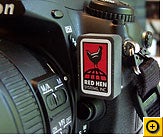
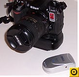
Blue2Can is a thumb-sized gadget that plugs into a small port on the front of several Nikon digital SLRs, including the D200, D2X, D2Xs, and D2Hs. It communicates wirelessly to any Bluetooth GPS receiver, like the kind that sits on your car's dashboard, the clip-on GPS device that I reviewed in May, or the Pharos gadget that combines multimedia features with GPS.
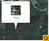
Blue2Can automatically tags your photos as you take them with GPS data (latitude, longitude, and altitude) that mapping software can read. Take a few pictures with Blue2Can attached to a Nikon camera, then upload them to your Flickr page, for example. Flickr adds a "map" link to each picture--click it and you can see where it was taken. Even cooler: You can view all your photos as pushpins on a map, so you can go on a virtual tour of that Grand Cayman vacation.
Manual Geotagging
But what if you don't have a Blue2Can-compatible Nikon camera? You can add location info after the fact. To do that, carry a GPS receiver with you while you shoot, and then use a program on your PC to synchronize the GPS data with your photos. RoboGEO is a clever program that can read the log from your GPS receiver and mark all your photos with the appropriate locations. And Sony has a gadget custom-designed for just this sort of track-your-movements photo duty, the GPS-CS1.
It is a pretty simple process, but it does involve an extra step to batch-process all your photos when you get them home.
If you aren't quite ready to step into the world of GPS, there are ways to mark your photos with locations manually. In Flickr, for example, you can display a photo and click the link labeled "Place this photo on a map" to pick a location off a map by hand.
It's not as glamorous as letting a billion-dollar military satellite system do it for you, but the end result is the same: You and your friends can see the photos were taken.
Saturday, June 21, 2008
Blue2CAN Review
Review of Red Hen Blue2CAN GPS Unit
The Red Hen Blue2CAN unit is one of the latest emerging technologies allowing photographers to encode GPS data with their photographs. I have earlier explored the many reasons why this is important (see http://wildportraits.com/gps.aspx for more details on GPS and photography), but the most obvious is the ability to sort photos by not only time but place.
As an early adopter of combining GPS with photography, I am always looking for the ultimate solution in allowing me to collect location data automatically with my photographs. I have had the pleasure of using the Red Hen Blue2CAN for the past month, and can fully endorse it. My early adoption of GPS units with my Nikon D200 has kept me searching for the optimal geotagging solution, and this latest unit from Red Hen is a welcome addition.
The Blue2CAN is a BlueTooth unit, and locks onto signals relatively quickly. The Red Hen unit works automatically with many Nikon DSLR cameras, including the D200, D2X and D2Xs), D2Hs, D3 and D300. It connects to the Nikon 10-pin remote on the front of the camera. It is also necessary to have a BlueTooth GPS receiver, as the unit connects to any nearby GPS receiver. If for some reason you have 2 BlueTooth devices, simply move one out of range (approximately 30 feet) until the desired unit connects to the camera, and then it stays locked on.
When first attaching the unit, the camera should be off. Once the camera is turned on, the light on the unit will flash 3 times, then search for a GPS unit. It continues to search at 20 second intervals until it makes a connection with a GPS. In field testing the unit, it locked on slightly faster than other units I have been using. In my experience, it kept the signal reliably, as long as the GPS unit is located within about 30 feet. Once it has locked on, it stays locked, allowing very fast startup.
It is a very small, measuring only about ¾"by 3/8". Unlike other units I have been using, it plugs right into the 10 pin connector, requiring no bulky mounts or cables. It is therefore by far the easiest of any unit I have ever had, adding a minimal footprint to the camera. Another major plus is its battery usage. I have found with other units that my camera is drained quickly when I leave the GPS unit attached, even when the camera is turned off. With the Red Hen unit, I have seen very little difference in battery life with the unit attached, so I have just left it on all the time, ready for instant use.
In practice, the Red Hen is very easy to use. In setting up the properties, through the menu, I simply enabled the Auto Meter function. Since the unit is designed to work with the Nikon technology, this then ensured all my pictures were stamped with the GPS data.
After a month of using the Blue2CAN, I can honestly say it is my new favorite GPS technology. It is so light and easy to use, I am really happy to be free of all the previous contraptions I have had connecting the GPS to the camera. This, combined with its significantly lower battery usage, make this unit a real winner. I strongly recommend it to anyone considering integrating GPS data with photography.


